
Today’s blog is about one of my favorite state parks: Caesars Head! I’ve been to every state park in South Carolina, but this is the one I’ve been to the most. My very first engagement session was here, and in November 2023, I did 3 engagement sessions here in one week! This park is free to enter, but there is a fee for some of the trails, which are not within walking distance of the visitor center.
If you’re positive you want engagement or elopement photos at Caesars Head, check out my details for elopement and engagement photos!

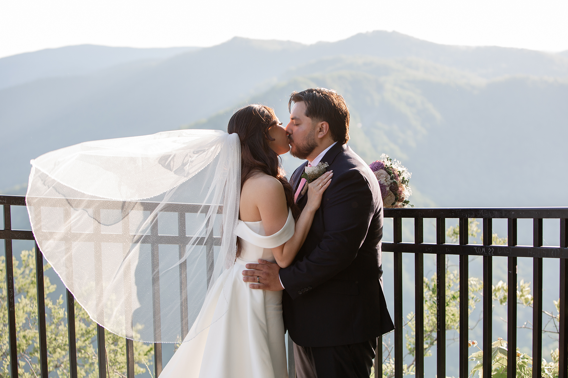
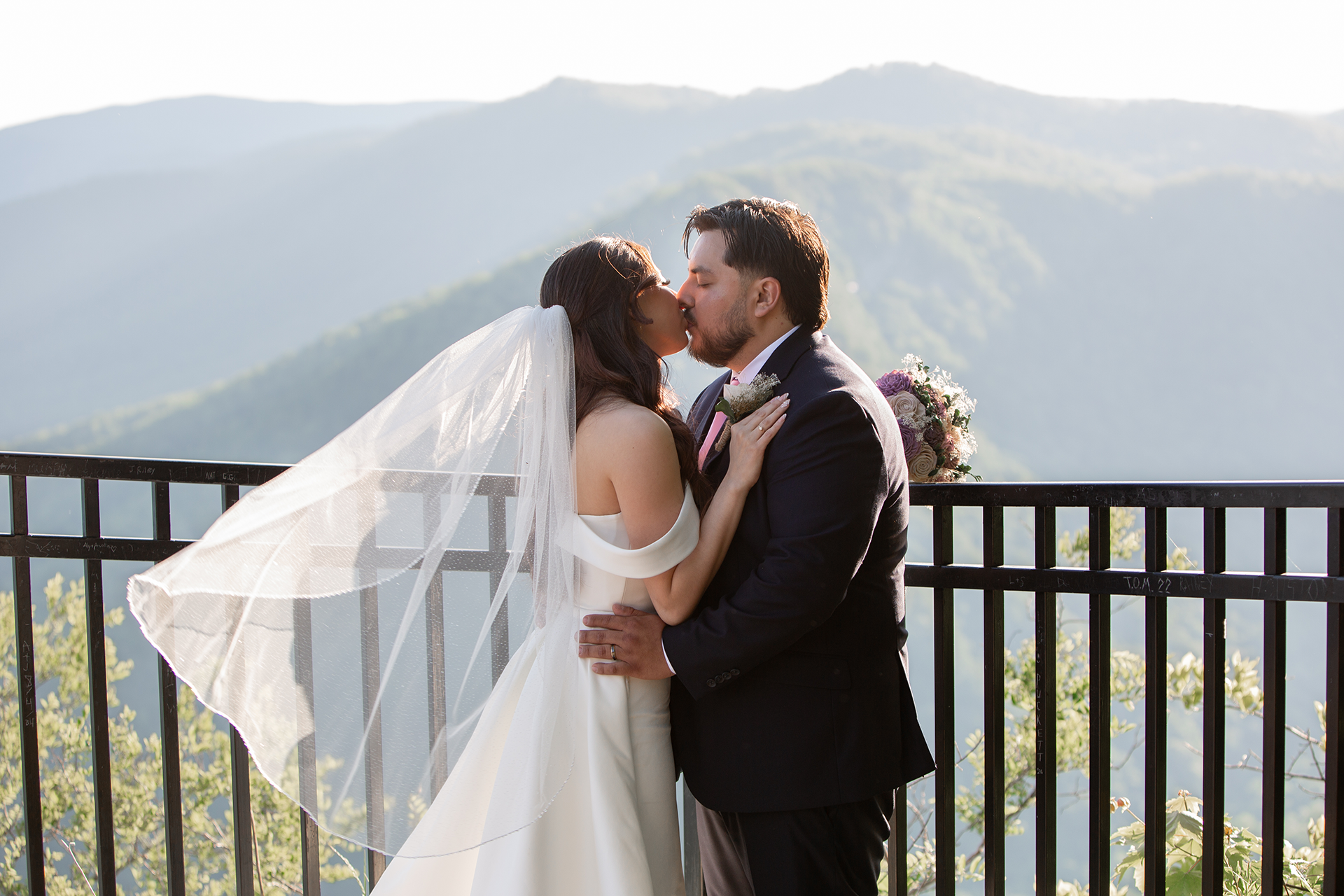
Some of the hardest hiking trails in the state are here, including two trails to Raven Cliff Falls, the biggest waterfall in South Carolina. Caesars Head is the biggest state park in terms of acreage. However, the area with the visitor center and overlook is pretty small and easily accessible. Getting to the overlook involves walking a short and paved walkway and stepping down a few rocks, which may be difficult for people with mobility issues, but you can still see the view from the walkway. The overlook gives a great view of Table Rock, which is especially cool to see if you’ve been to the top of it.

The stripey rock ahead of the couple is Table Rock.
Caesars Head is one of the headquarter locations for Mountain Bridge Wilderness Area, along Scenic Highway 11. The other headquarter location is Jones Gap, which is another beautiful park.

Many people find Caesars Head because they’re visiting Pretty Place Chapel, which is about 20 minutes north on the same road and right on the North Carolina border. Pretty Place faces east and has a stunning view for sunrise, but Caesars Head faces west and has an amazing view for sunset. I’ve had a few engagement sessions that used both at sunset. Caesars Head usually opens after sunrise, so I’ve never actually seen it early in the morning and I’ve never done a sunrise session there.
Caesars Head has a cave-like area called Devils Kitchen. On the side of the overlook, there’s a very narrow staircase between two rocks. Once you cross between the rocks, the path will lead you through the woods and back to the overlook or the parking lot. All in all, it only takes a few minutes to do the loop.


Since the area around the Caesars Head overlook is pretty small, it’s ideal for a 30-minute session, like a proposal. I’ve also had a few sessions that combined Caesars Head with Pretty Place, but you could also combine it with Bald Rock or Wildcat Wayside.

Bald Rock Heritage Preserve

Wildcat Wayside
Like any summit, there’s the possibility that the clouds or the fog will block the view. Cloud inversion, where it looks like you’re above the clouds, usually happens closer to sunrise, before Caesars Head opens. However, it rains for a long time before your visit, there could be a haze that’s too thick for you to see anything. Here’s what it looked like for a rainy session I had there:

I have a whole blog post about cloudy days, but one thing you can do is go to Accuweather and check the hourly forecast for Cleveland, South Carolina. If the cloud ceiling is lower than the elevation of Caesars Head (3100 feet), then you might not see anything from the overlook.

This is a really windy road, so make sure anyone who gets carsick is prepared for that. Here’s a screenshot of the last 4 miles or so before Caesars Head, coming from Greenville:

For more information on South Carolina State Parks, check out my post about all of them! For more places in South Carolina with mountains, check out Table Rock, Pretty Place, and Devils Fork!
More from the South Carolina Mountains


Ready for the best day ever?

Photo by Shehzad Ziaee
My name is Christine (Scott) Gow and I’m an elopement photographer based out of Greenville, South Carolina. I’m a wife and a beagle mom. The three of us have visited beautiful places in every corner of South Carolina, to include all 48 of our state parks. Sometimes we wear hiking boots, sometimes we wear dress shoes, and sometimes we’re barefoot in the surf.
One thing I love about South Carolina is that it’s not just the beaches and colorful houses that you imagine when you picture it. Whether you’re looking for mountains, beaches, or anything in between; I can help you find the perfect place for the two of you and make it as smooth of a day as possible. No matter how you two choose to spend your day, I’m happy you’re doing it the way that you want.
I can’t wait to meet you!